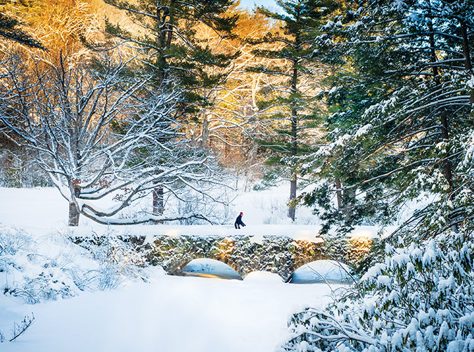
If there’s one thing the North Shore can boast come deep winter, it’s plenty of prime cross-country skiing trails. Here’s a roundup of all the beautiful outdoor areas in our region where you can strap on your cross country skis and head out for a day of enjoying lovely winter weather.
Alpine skiing more your thing? Check out our full Ski Report for the snow conditions and operating statuses of your favorite area mountains.
—
North Shore Nordic Association
Just a couple years old, the NSNA brings ski trail grooming to a network of parks on the North Shore, namely Bradley Palmer State Park, Appleton Farms, and Pingree Woodlot. The association maintains a system of trails with trail maps, signs, and low impact grooming that won’t disturb the underlying trail structure. The trails wind through parts of Topsfield, Hamilton, and Ipswich.
parking
At the Appleton Farms Dairy Store; at the Appleton Farms Highland lot; at the Bradley Palmer Highland lot; at the Bradley Palmer main lot.
View a map here.
—
Martin H. Burns Wildlife Management Area, Essex
Length: 3.4 miles
This unpaved route was once used for a trolley line and now serves as a utility corridor. Heading west from the station, the trail crosses Little River, then Highfield Road, before entering the heavily wooded 1,555-acre wildlife area. On its western end, it passes two wide trails that lead out towards Orchard Street in Newbury. The trail ends just before I-95 and is nice and quiet. Keep an eye out for deer, fox, beaver, and a medley of bird species. Note: On the other side of the train station, north of Parker Street, a connection can be made to the Clipper City Rail Trail that heads north to the Merrimack River.
PARKING
Eastern Trailhead: At the Newburyport MBTA station parking lot.
Western Trailhead: At the gate, at the end of the dirt road, off Orchard Street.
View a map here.
—
Topsfield Linear Common and Wenham Rail-Trail, Boxford
LENGTH: 4.9 miles
This trail starts in Boxford and winds its way along an abandoned rail bed through Topsfield, meandering across Route 1, over the Ipswich River, and through a wetland area. Just south of the river crossing, you can connect to the Salem-Beverly Canal Path along the old waterway built in 1917. At its southern end, the trail passes through the Great Wenham Swamp. Be on the lookout for lots of wildlife, particularly marshland bird species.
PARKING
At Pye Brook Park off Bare Hill Road; Proctor School off Grove Street by the tennis courts; at Park Street near Main; at the Village Shopping Center off Main Street; at the Route 1 crossing.
View a map here.
—
Harold Parker State Park, Middleton
LENGTH: Over 35 miles
This park consists of over 3,000 acres of hemlock and white pine forest. Rolling hills, low-lying swampy areas, rock outcrops, and several ponds dot logging roads and trails covering parts of Andover, North Andover, North Reading, and Middleton.
Note: There are maps at the headquarters entrance.
PARKING
At the headquarters.
1951 Turnpike Rd., North Andover. View a map here.
—
Ipswich River Wildlife Sanctuary, Topsfield
LENGTH: 12 miles
The sanctuary is made up of interconnecting trails through forests, meadows, and wetlands and is home to owls, wild turkeys, woodpeckers, hummingbirds, and warblers. Trails lead to a vernal pool, an observation tower, along boardwalks, and up a drumlin and an esker. There is also a unique rockery, a grotto of narrow passages, and caves constructed in 1905. Watch for river otters, painted turtles, and great blue herons at various times throughout the year.
PARKING
At the visitor center.
87 Perkins Row, Topsfield. View a map here.
—
Bald Hill Reservation, Boxford
LENGTH: 1.75 miles
The reservation touches parts of North Andover, Boxford, and Middleton. Bald Hill covers 1,700 acres of forested hills and low-lying swamps. The conservation area is home to white-tailed deer, fisher, mink, otter, and other wildlife, making it a prime spotting site.
PARKING
At the kiosk.
Middleton Road, Boxford. View a map here.
—
Ward Reservation, Andover
LENGTH: 10 miles
The reservation trails link three major hills—Shrub, Boston, and Holt. The “Solstice Stones” mark the summit of Holt Hill, the highest point in Essex County. Almost 10 miles of easy to moderate trails make this a great place to spend the day. Some of the trails are part of the Bay Circuit Trail, a greenway linking the North and South Shores.
PARKING
At the small lot off Prospect Road.
34 Prospect Rd., Andover. View a map here.
—
Brooksby Farm, Peabody
LENGTH: 3 miles
Footpaths and trails wind through historic houses, red barns, and 65 acres of orchards. Rent skis or snowshoes at their Ski Haus, typically open on weekends and school vacation days when there in snow on the ground. Check their website for additional weekday hours.
PARKING
At the farm store.
54 Felton St., Peabody. View a map here.
—
Old Town Hill, Newbury
LENGTH: 3 miles
A tidal river, salt marsh, open fields, and woodlands characterize Old Town Hill, a link in the Bay Circuit Trail. Mount Agamenticus in southern Maine is visible from the 168-foot hilltop. A three-mile network of trails and pathways winds through wetlands and up to views of protected open space along the Parker River.
PARKING
At the small lot off Newman Road.
Newman Rd, Newbury. View a map here.